Gallery
Beach features
Sospan Dau
Plants and animals
Seasons
The beach in Google Earth
Beach Features
 |
 |
Where the porosity of the beach is greatest, so much water penetrates over high tide that it is sufficient to form temporary springs near the toe of the beach as it all rushes out again. |
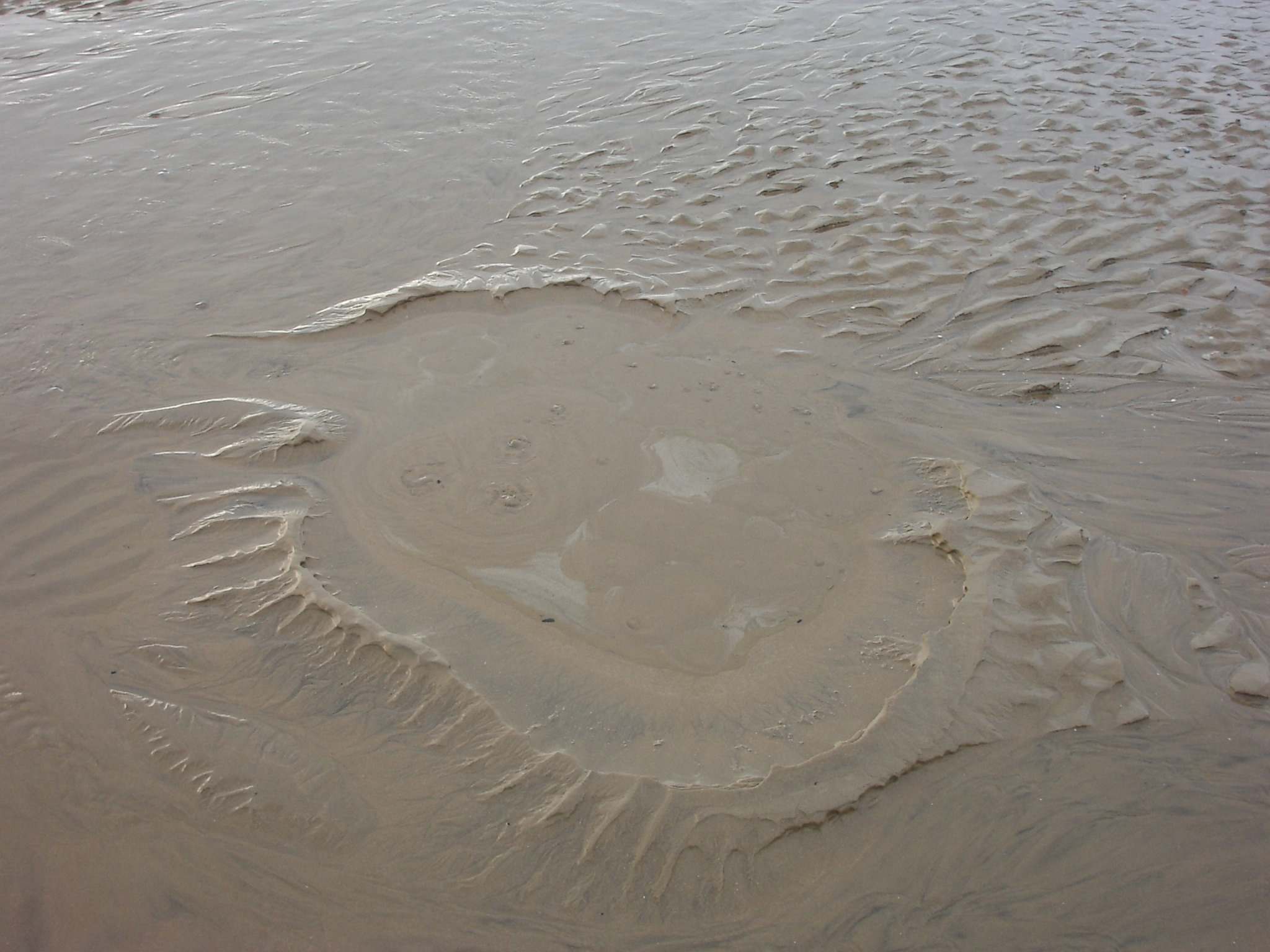
Mud holes or 'mud volcanos' develop occasionally on the lower sandy foreshore. At these points, water is welling up in the form of an artesian spring driven by the higher water level in the beach. Consequently, they are most active as the tide goes out. They are dangerous in that sand is liquified and one can sink in easily to knee depth or beyond. |
Sospan Dau
 |
 |
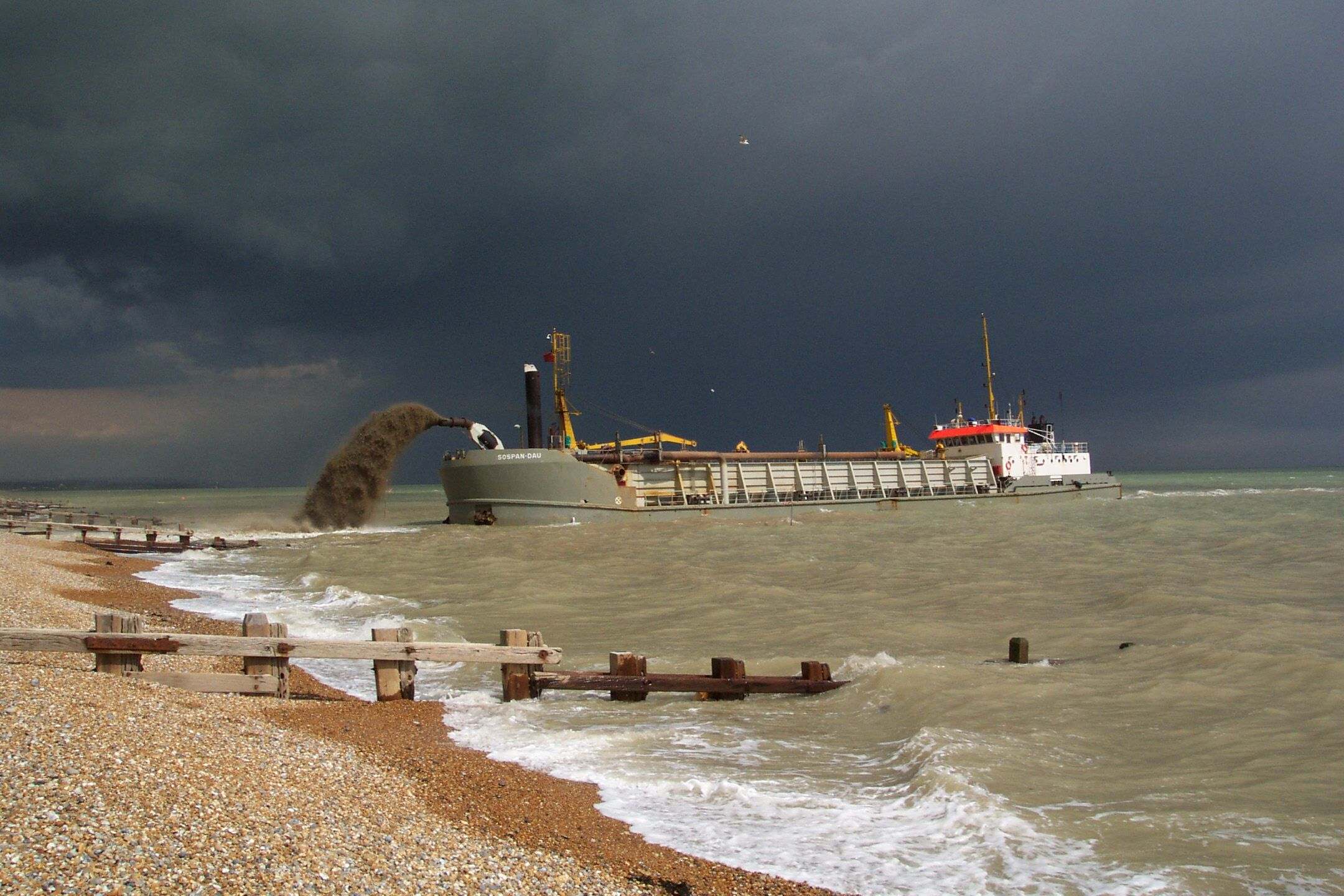
Dredger Sospan Dau discharging shingle against the background of an approaching thunderstorm |
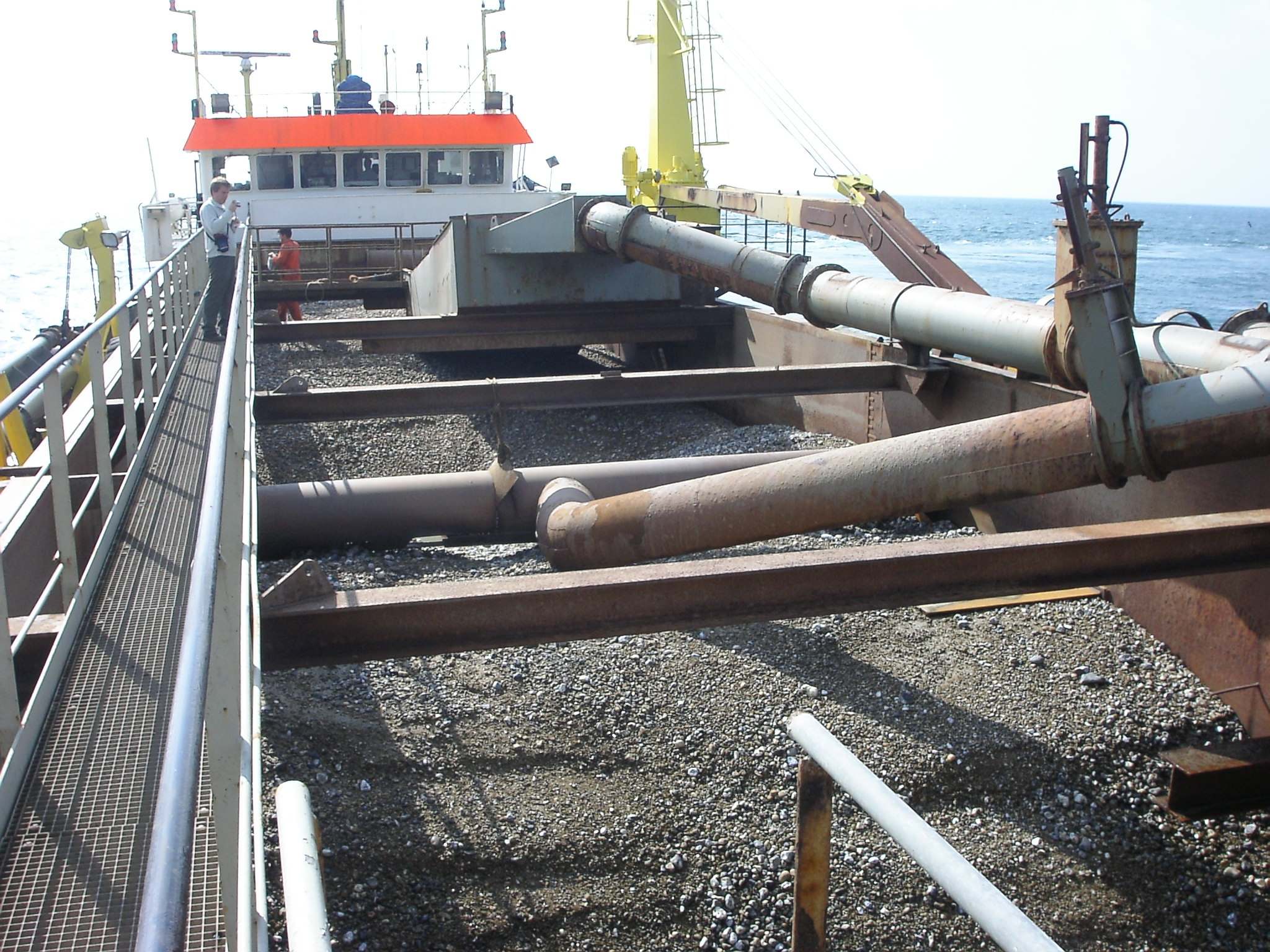
Dredged material inside Sospan Dau's hopper awaiting discharge. |
|
|
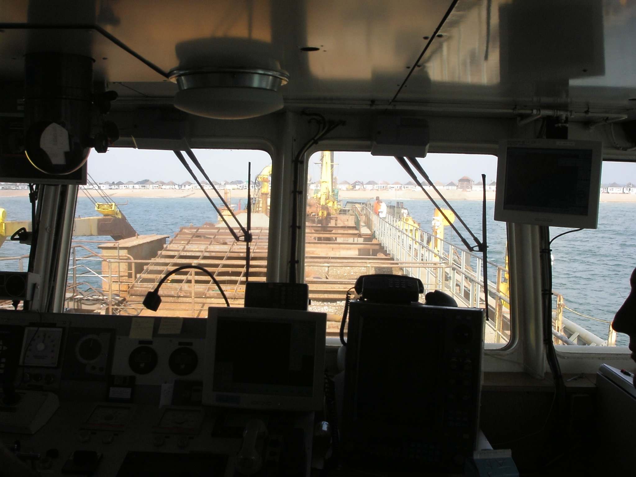
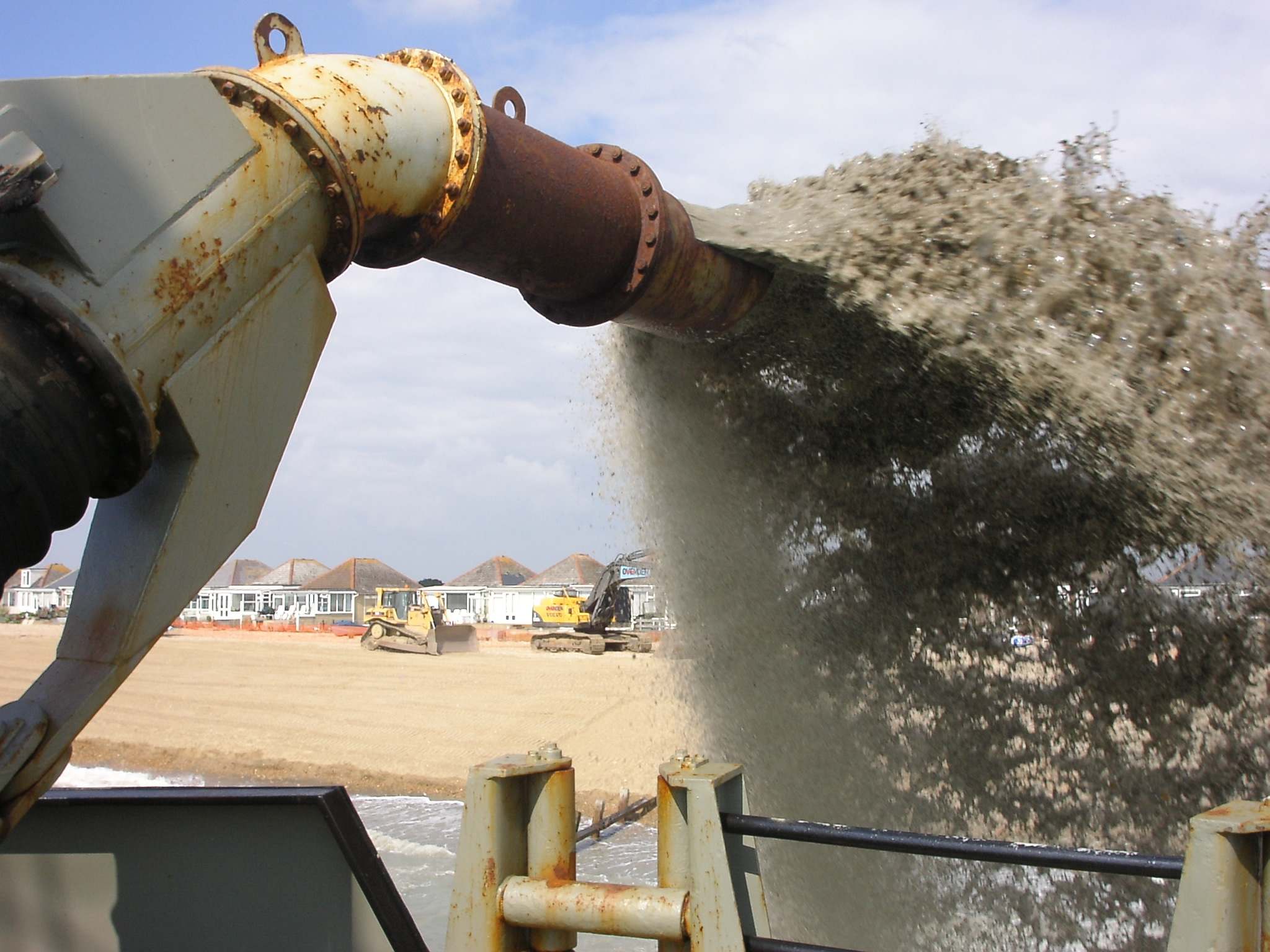
Shingle and seawater mixture being "rainbowed" on to the foreshore at Beachlands. | View from the bridge of Sospan Dau as it approaches Beachlands in 2005 |
Plants and animals
 |
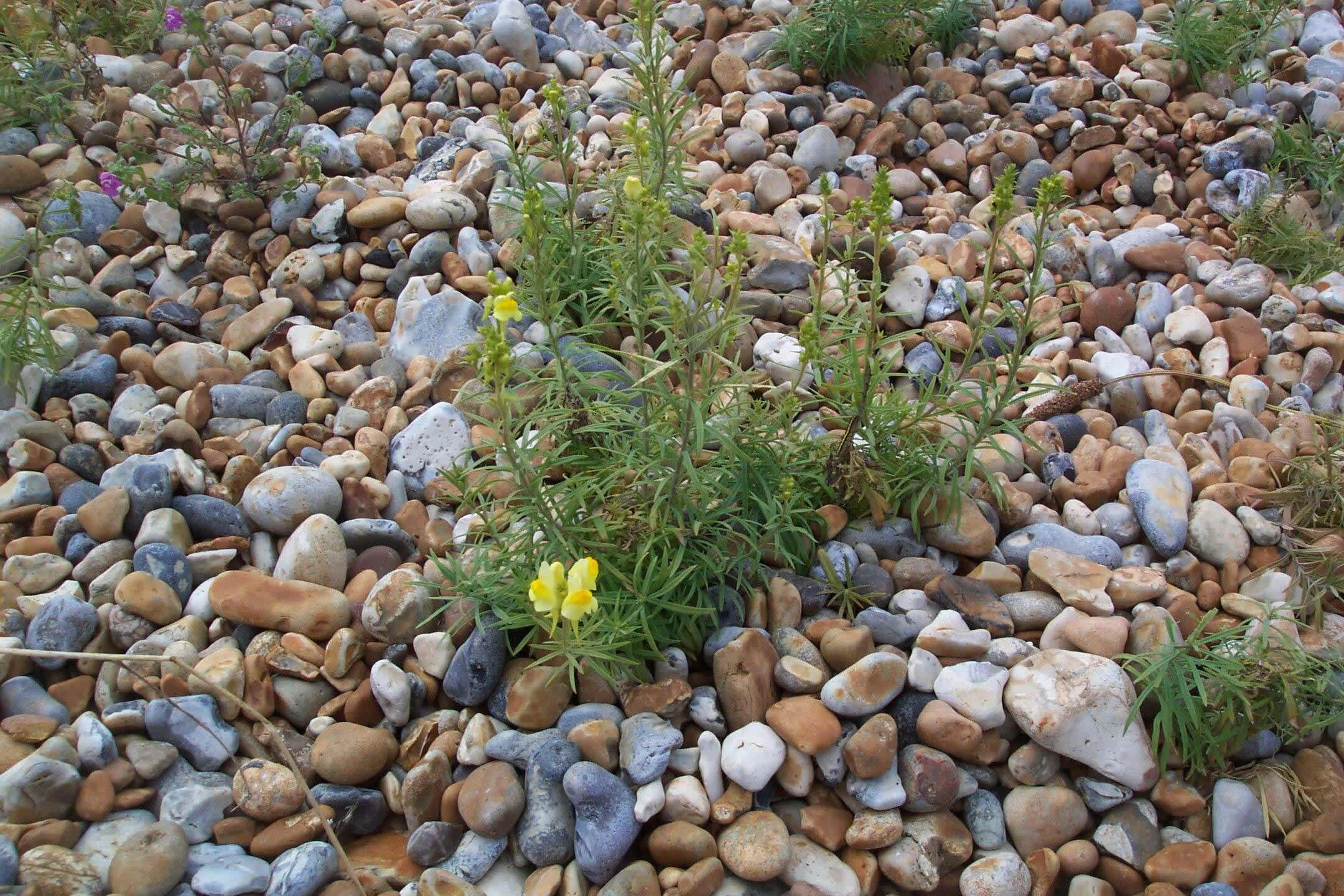 |
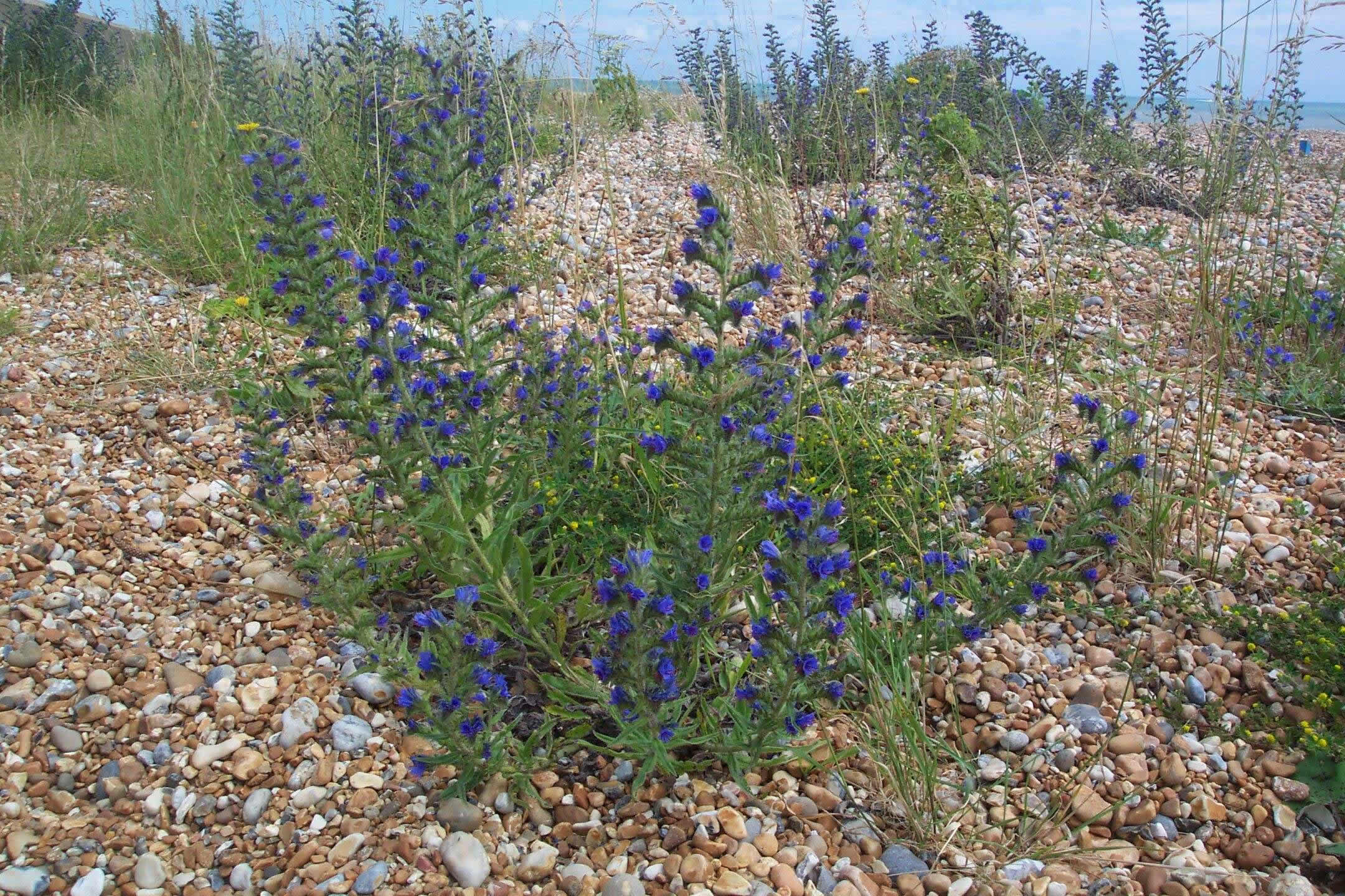
| Vipers Bugloss (Echium Vulgare) | Toadflax (Linaria Vulgaris) |
Seasons
 |
 |
| Snow on the beach on 23 February 2005 | Snow on the beach on 23 February 2005 |
The beach in Google Earth
 To see images of Pevensey within Google Earth (you need to have Google Earth installed on your computer) click on this link. When asked if you want to download or open, select open. Google Earth should start with the globe spinning until Pevensey is in the centre. Use the zoom control to zoom into the area and thumbnail images of the coast should appear on which you can click to view larger images.
The photos provide a ground view along the beach taken from locations near groynes taken on 7th June 2007.