Beach Surveys

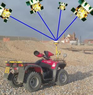
Beach monitoring through Global Positioning System (GPS) surveys is very important in terms of informing maintenance decisions. By comparing different surveys, the amount of replenishment, reprofiling and recycling can be targeted to when and where it is most needed. In this way we can ensure that not only are all area of the frontage adequately protected, but also that work is only undertaken when necessary. Using a GPS receiver mounted on a quad bike, surveys are carried out over the whole frontage using either one or two low tides on successive days. Though the system works on the same principle as Satellite Navigation (essentially the same as a car or mobile phone sat nav system), it is much more accurate; appositionally to 15mm horizontally and 30mm vertically. The receiver calculates its position from satellite signals and compares them to a second set of data transmitted from a base station operating on a fixed known point. By merging both datasets, the receiver refines its position to centimetre accuracy.
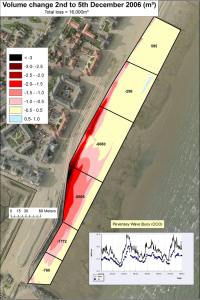
Back in the office a digital ground model is created and volumes for 53 discrete sections are calculated and compared to target quantities. The difference between them identifies areas where more work is required and where surplus material is available for recycling. Surveys can be compared to see exactly where and how much beach has moved over the month.

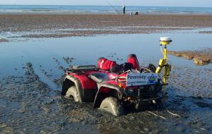
Surveys are carried out every month on spring tides. Lowest tides are always very early in the morning which is fine in the summer but less enjoyable in the winter. Surveying the sandy foreshore can be particularly dangerous as soft spots, that mainly develop locally in the summer, are difficult to spot and can lead to the quad bike running into problems.


